Sunday, February 23, 2020

Last Day in Hawaii


Saturday, February 22, 2020

Today we said goodbye to our beautiful airbnb.


Our flight home was not until 10:20 pm (ugh!), which gave us the day to explore.
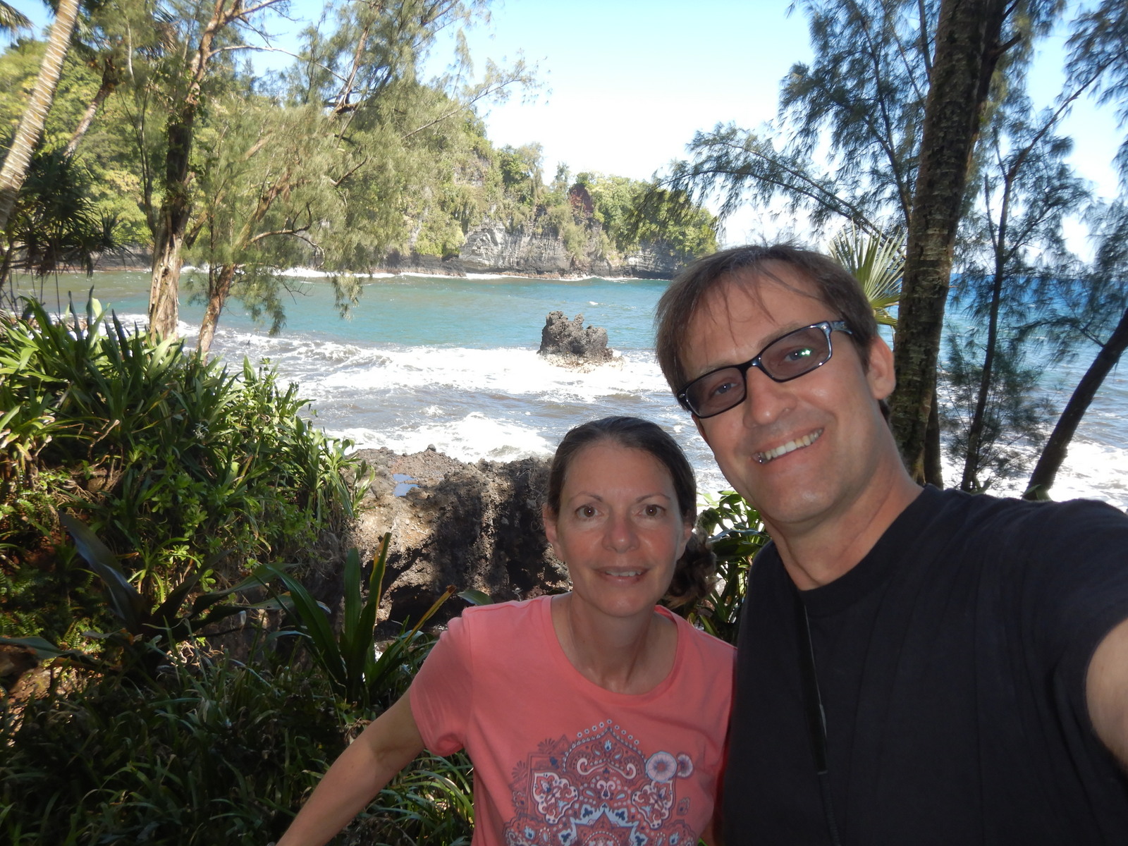
We drove back towards Hilo and then a little furthur to Hawaii Tropical Botanical Gardens. This is one of the nicest botanical gardens we have ever been to!!!  Karin, I thought of you the whole time!


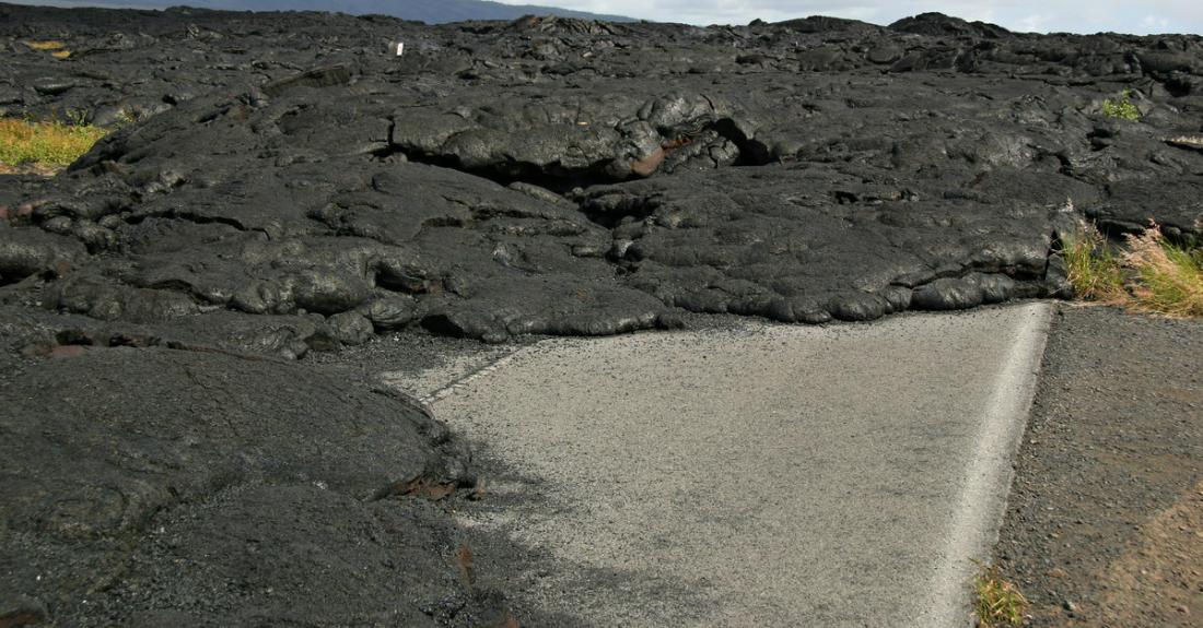
Then we found Kaumana Caves.  These are lava tubes that make the Thurston Lava Tube look like an amateur.  These caves made from lava are 40 km long and NOT lit for tourists!  They were created in 1881 from lava from Mauna Loa, and it ranges from 3 feet to 30 feet in height.  


We had to scramble in and then carefully make our way across the lava bottom.  We went about 15 to 20 minutes in before we turned around.  Anton used the light on his cell phone, then turned it off and it was pitch black.  Spooky!


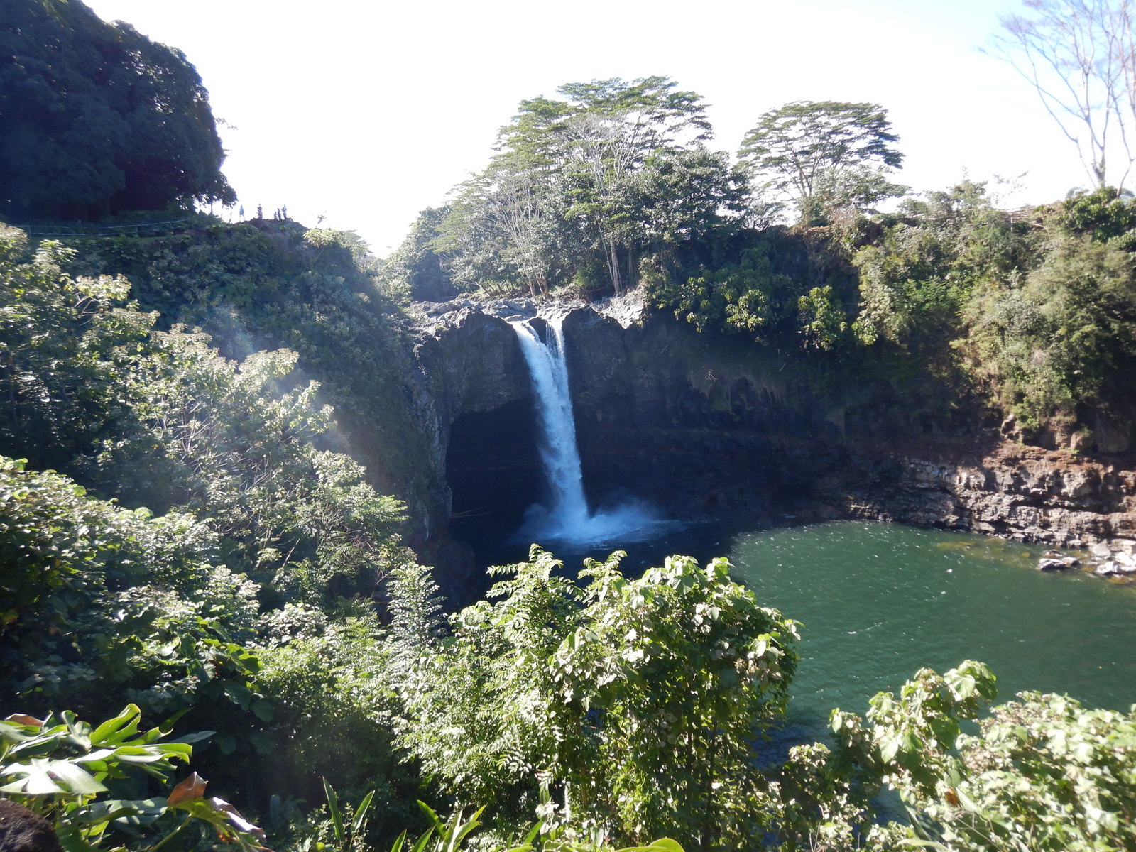
Then we went to Rainbow Falls, 80 feet tall, and 100 feet wide:


We walked through a tree root forest:


This is called Boiling Pots, because after a storm when the water level is high, it looks like the water is boiling:


Then we parked near the ocean and walked for awhile.  There is a bridge over to Coconut Island. It is a 28 acre island which is basically a park and hangout.


Banyan Drive is a street lined with large banyan trees which have withstood several tsunamis. Banyan trees are native to India, and the first banyan (called Lahaina Banyan) was presented to the sheriff by missionaries from India. It was planted in 1873.


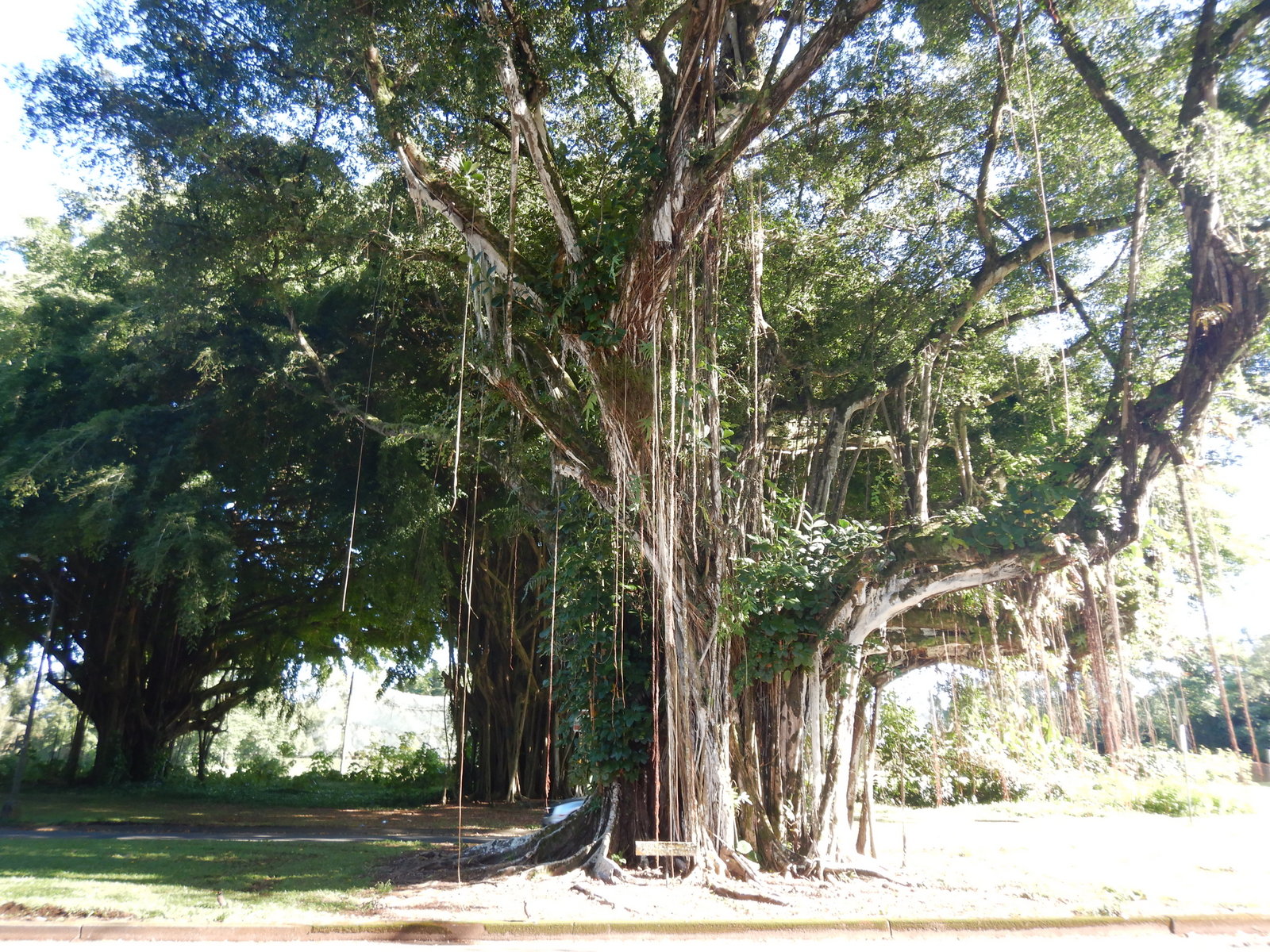
Banyan Drive is called the "Hilo Walk of Fame" because of the several celebrities who have planted trees here.  We saw the ones planted by Amelia Earhart, Cecil B Demille, and FDR Roosevelt. 


Banyan Drive is where we found more shave ice.  They were a bit drippy.  Frankie's white socks are now died blue from the syrup.


Then we walked through Liliʻuokalani Park and Gardens. It is the largest authentic ornamental Japanese garden outside of Japan.


Supper was at a restaurant named Pineapples.  They put pineapple on every dish on the menu.


Our flight was at 10:20 pm, so we returned our rental car and had a lot of time at the airport to kill while we waited.


We land in LAX at 5 am local (3 am Hawaii time), then an hour and a half to find our connecting flight.  We are due in to Toronto at 2:40 pm. Watch out, there will be zombies driving on the 401!


Saturday, February 22, 2020

Volcanoes National Park Day 2


Friday, February 21, 2020


For today, we went back to Volcanoes National Park and decided to drive along the Chain of Craters Road (31 km).  The Chain of Craters Road is full of overlooks and pullouts.  Lots of lava and craters.

The Lua Manu Crater (Bird Crater) filled with 50 feet of lava in 1974 with the eruption of a different volcano, and then the lava drained again. You can still see the “high lava mark”.


Hilina Pali (Windy Cliff) Rd is a 14.5 km drive that takes you to an overlook. That seemed to be a long ways to go for just an overlook, but along the way there is a 16 km long fault line. It is a "reversed or backward fault", formed by the downward movement of sections of mountainside. That's cool.


Pauahi (Destroyed by Fire) Crater measures 2000 feet long, 300 feet wide, and 500 feet deep.


Before the 1969 eruption of Mauna Ulu, this area was a dense forest.


We hiked for miles trying to find Mauna Ulu (Growing Mountain) Crater.  We eventually climbed a ridge hoping to find it.  Later, from the viewpoint at Pu'uhululu, we realized that the ridge actually was the crater. 


We looked for Mau Loa O Mauna Ulu (The long Continuous Growing Mountain) but could not find it.  This is where the lava flow continually crossed and recrossed the Chain of Craters Road. 

The Chain of Craters Road

Kealakomo (The Entrance Path) is an overlook. All you can see is lava fields, but there used to be a village here (until it got covered).


Pu‘u Loa (Long Hill, which really means Hill of Long Life) is the largest petroglyph field in Hawaii. It is dated between 1200 - 1450 A.D. There are more than 23,000 images. A lot of the images are "pukas", a ring of concentric circles with a depression in the center where they placed part of a baby's umbilical cord to ensure it would have a long life.  You can see some of the petroglyphs behind us:


We went as far as Chain of Craters Road could go.  The road used to go farther until it was buried in 1969 during the Mauna Ulu eruption.


In 2014, crews used heavy machinery to break and crush the lava that was blocking the road so that they could create an emergency access road.  This part of the road is along the Pacific Ocean:


On the way back, we noticed a lot of cars parked at the Thurston Lava Tube, which has been closed for 2 years since the big 2018 eruption.  We stopped and asked a ranger, and he said it re-opened just today!  Psyched!  How lucky are we!

The Thurston Lava Tube is a 500 year old cave, and was formed when a river of lava gradually built solid walls and a ceiling.  This lava tube is about 200 meters long.


Hawaiian movie of the night: Soul Surfer.  Very inspiring movie.


Friday, February 21, 2020

Hawaii Volcanoes National Park


Thursday, February 20, 2020

The average temperature here in February is 20C, low 10C. A nice transition to home?

Started the day by feeding Stephen's fish:


Today we just set off on our own through Volcano National Park. There are over 2 million visitors to the park every year. Maybe they all want to see a volcano erupt like we do? 

Fast facts about Volcano National Park:

  • The park was established in 1916.
  • It is 323,431 acres large
  • Elevation varies from 0 to 13,667 feet.
  • It has 2 active volcanoes
  • It became a UNESCO World Heritage site in 1987.
  • The park has 7 ecological zones.
  • 59 endangered species live here.
  • The park has over 1000 species of plants, 90% of them only exist here.
  • The park has 106 km of paved roads and 250 km of marked trails.
As soon as we got into the park, we headed straight for The Kilauea'iki Trail, which can get quite busy.  This was a 6.5 km loop trail that started by skirting the rim of the crater, then dipped down into the crater itself, and back up the other end.


It was very cool to walk across the floor of an actual volcanic crater.  The crater floor was formed only 50 years ago.  The crater is 1.6 km long, almost a km across, and the floor of the crater is 122 meters below the rim.


Next we went to see the steam vents and the steaming bluff.  The steam is caused by ground water seeping down onto the hot volcanic rocks.


Across the road was the Sulphur Banks Trail.  Here the volcanic gases and steam escape from the ground and leave colourful mineral deposits.


We drove up Mauna Loa Rd for a bit.  Here are some Lava Tree Molds.  These were formed when lava surrounded the trees.  The trunks were waterlogged so did not burn right away, and the lava hardened around the trees.  However, the lava was too hot for the trees, and they eventually all combusted and burnt away, leaving hardened lava holes deep into the earth.


Anton fed a wild chicken:


The next hike we did was called Kipukapuaulu which was a 2 km loop through a forested area, very pretty.  But we renamed it Falling Tree Trail because we couldn't even count how many trees had fallen and had to be moved away from the path.


The road up Mauna Loa was very pretty.


Our next trail was just outside the park, the Ka'u Desert Trail, 2.5 km.  We loved this trail because we were walking through fields and fields of lava rocks and boulders.


Part way into this trail, you can see footprints where people walked through volcanic ash from the 1790 Kilauea eruption.  They found 1773 footprints here:


Back into the park, we wanted to see how far we could get on Crater Rim Drive.  You used to be able to drive all the way around Kilauea, 18 km.  Now since the 2018 eruption, only about a third is open.  We could only go as far as Devastation Trail.  In 1959 Kilauea'iki erupted and sent a fountain of lava 580 meters into the sky, incinerating the forest that was here.


Well, we had done enough hiking for the day, so we had dinner at Volcano House.  It was disappointing because we thought it was going to be a really nice restaurant.  Instead, Anton got pizza and Frankie had to order 3 sides just to get a meal.  And they actually brought it as 3 sides ha ha.  And then as we were leaving, we saw that the nicer restaurant was in a different area.  And we were glad we didn't eat there when we saw the menu and prices!  

Consolation:  the cheaper restaurant had wonderful views of the Kilauea Crater!


We set a new record today:  almost 26,000 steps!!!

Thursday, February 20, 2020

The Big Island


Wednesday, February 19, 2020


Today we had a leisurely morning, checkout from our condo was at 11 am.  


It was a short one hour flight, and we were in Hilo on the Big Island.


Here are some fun facts about The Big Island:

The population of The Big Island is roughly 187,000 people. 

The Big Island has 5 volcanos, 2 of which are still active.

Big Island Hawaii Volcanoes

The Big Island is the largest and youngest Hawaiian island, at 148 kms long and 122 kms wide. Because of volcanic lava eruptions, the island grows about 42 acres per year. In 2018, however, Kilauea erupted steadily for 4 months, and the island grew by 875 acres. There was enough lava to fill 320,000 Olympic sized swimming pools. The eruption added up to 180 feet deep of lava in some parts of the island, and 700 homes were destroyed. And yet scientists estimate that only 11-33% of Kilauea's lava was expelled.


The Big Island is slowly moving away from the hot spot which created the islands, and a new island is already being formed 24 kms southeast. The island has already been named Loihi, even though it still has one mile to go before it breaks the surface of the ocean.


Hawaiian Islands Map

Since 1812, the island has recorded 24 tsunamis. The most devastating was in 1946, when it was hit with a 54 foot wave (over 16 meters).


We had pre-booked a car rental from the airport, and found our way to the Hilo Farmer's Market.


Then we bought groceries in Hilo because there is no grocery store where we are headed.  The store was small and crowded and it took us over an hour to decide what we wanted.

We drove almost an hour from Hilo to our rural airbnb, right outside of Volcano National Park. We have the gorgeous main floor and the owner Stephen lives upstairs.  Here is Anton making supper while Frankie does much needed laundry:


We picked it for the lovely property and large koi pond, which Stephen said we could be in charge of while we are here.


This place is absolutely wonderful.  At the condo in Waikiki, we were starting to yearn for home, but this is place is so nice that we love it.  And Stephen has stocked up on everything, including a fresh fruit platter.  Frankie loved the fresh papaya, and Anton is everything pineapple, of course!


Last night after supper we watched the 1961 movie Blue Hawaii with Elvis Presley.  Angela Lansbury played his mother!  The movie had great Hawaiian scenery and music, but by golly, there is no way Elvis could get away with that kind of behaviour today!!!

Image result for blue hawaii movie poster