Friday, February 28, 2025

Mt Cook/Aoraki Day 2

 Friday, February 28

Today we hiked from 9:30 am to 4:30 pm!!!  Another beautiful, clear, sunny, warm day.

We had seen pictures and really wanted to hike the Hooker Valley Track.  It is actually known as New Zealand's best day walk.

Imagecredit: https://www.jennyfaraway.com/new-zealand-walks-for-wimps-hooker-valley-track/

It is a little over 10 km return and takes 3 hours, or 4 hours if you start from the village (which is why we drove up to the campground and started there).  The sign said 1 hr 35 mins to reach the end from the start point.  We took it at a moderate steady pace and let all the 30 year olds pass us (plus all the couples with infants in baby backpacks).  We took 1 hr 40 mins which we thought was pretty good!

imagecredit: https://wanderlustphotosblog.com/2019/08/23/new-zealand-photo-prep-part-6-photography-planning-for-aoraki-mount-cook-south-island/

We had great views of Mt Sefton, this is the one we can see from our lodge window:


The track leads up the Hooker Valley towards Mount Cook.  It has 3 swing bridges (suspension bridges) and ends at the glacier lake.  Anton was not a fan of these bridges:


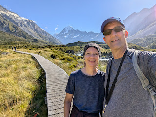
It was a nicely graded flat track.  No need for the walking stick.  One section had a long boardwalk:


We got to the end and ate a few granola bars and rested.


On the way down, we stopped to see the alpine tarn:


This is an alpine memorial for those who have lost their lives in these mountains:


The front listed one hiker and 2 guides who were swept in an avalanche in 1914.  Then we went around the side and saw dozens of names.  Mostly 20 year olds.  Swept up in an avalanche.  Fell off the mountain.  Equipment failure.....


This is called Freda's Rock after Emmeline Freda Du Faur, the first woman to summit Mount Cook.  Because she was a woman in 1910, she had to climb with 2 male guides and wear heavy skirts.  They apparently took only 6 hours to make the ascent.


When we got back to the campground, we found a shady spot for "lunch".  Just whatever food we have left at this point.


Also starting at the campground is the Kea Point Track.  This one is about 3 kms and one hour return to the campground.  It takes you to the Mueller Glacier moraine wall.  This area was formed in 1913 when a stream cut through from a glacier, and actually damaged the original Hermitage building which was built in 1884.

Imagecredit: https://www.alltrails.com/trail/new-zealand/canterbury/kea-point-track

This trail had spectacular views as well:


The Sealy Tarns Track branches off from the Kea Point Track. 

imagecredit: https://wanderlustphotosblog.com/2019/08/23/new-zealand-photo-prep-part-6-photography-planning-for-aoraki-mount-cook-south-island/

It is 6 km long and considered challenging, mostly because of the 2200 steps you have to climb.  It takes 3-4 hours return.  We did about 10 minutes and then turned back.  Didn't even get to the hard part yet.


We got back to our lodge, had a short rest, and then hiked the Governors Bush trail again.  We just could NOT find the loop, oh well.  It was still very nice:  cool and secluded. 


We had a close encounter with a New Zealand Pigeon:


No fancy expensive dinner for us tonight.  We were quite happy to go back to the Chamois Restaurant and share a gluten free pizza!


Thursday, February 27, 2025

Mt Cook/Aoraki Day 1

Thursday, February 27

The morning started off at a chilly 14C and by the afternoon it was 24C.  So you'll notice different layers of clothing as the day goes on.

Our lodge room bathroom floor is heated, giggle giggle.  Not your average motel!

Here is a map of the village and some of the trails in the area:


We had to drive over to the Heritage (the main hotel) for breakfast.  This hotel is the nicest hotel we've EVER seen!  And absolutely huge!  This was our view as we ate breakfast:


We checked out the humongous gift shop, nothing under $300.  They even have a museum here called the Sir Edmund Hillary Alpine Center.  $50 to discover the history of the region????

Behind the Hermitage, we found the Glencoe Walk (see map).  It was short and steep but not too bad:


It led up to this viewpoint:


We made our way back to our lodge, parked there, and from there did the Governor's Bush Walk (see map).  It was supposed to be a one hour loop through a silver beech forest, but somehow we ended up cutting through it and coming out the side????  Oh well, it was still very very lovely:


The forest was very abundant in ferns.  Karin, if you are dividing any ferns this summer, don't throw them away, we'll take them!


We also found the Red Tarns Track, just south of the village.  A "tarn" is a small mountain lake.  They are named Red Tarns because of the red pond weed that grows in them. This trail passed over the Black Birch Stream, we swore we saw Frankie's phone swim past us ha ha:


The trail was so steep that we went about 15 minutes up up up and when there was no end in sight, we turned around and went down down down:


We later found out that this particular hill (Mount Sebastopol) was used as Minas Tirith in The Lord of the Rings.  You can kind of see the flat plateau on the left:


For lunch, we took some leftovers over to the Hermitage and ate there.  Anton ate a banana and a chocolate bar (his standard).  Frankie had a cheese and spinach pocket from the gluten free bakery, but it was pretty dry and needed microwaving.  At the Hermitage reception, she had to sign an actual food wavier and then they let her use the staff microwave in the staff room.  As she waited for the food to heat, she noticed a printout called "How to get into a Guestroom Safe".  Hmmm. We ate in their extremely large bar area, here's the view:


After lunch we had half an hour before our tour, so we walked 1 minute to the Visitor Center which had some interesting exhibits, like this old pair of mountain boots:


They had a display with Frankie's favourite Bible verse:


In the afternoon, we took the Glacier Explorer tour (we had to book this one 6 months in advance!), leaving from the Hermitage Hotel of course.  It was 3 hours long, from 1:00 to 4:00.  First we had a 12 minute bus ride to The Blue Lakes parking area.  Then we had to walk 1.5 km just to get to the glacial lake.  


There were 32 people on the tour so they divided us into 3 boats, we had 9 people in ours.  The boat driver introduced himself, his name was Anton!!!  When Anton told him that he was also an Anton, he gave Anton a huge hug.  He was very funny and entertaining, and this was his very last tour ever, so at the end of the tour he ripped off his name tag and gave it to Anton LOL.


The boat ride was on the Tasman Lake, 150 meters deep.  We skirted around quite a few icebergs. Unlike ocean icebergs which are 30% above water and 70% below, the water is very dense here and the icebergs sit 10% above and 90% below.


We could look straight up at Mount Cook, 3 kms straight up.  Two out of three days Mount Cook is obscured by clouds, but today there was not a cloud in the sky and no wind whatsoever.  An absolutely perfect day!


We were amazed at the height of the lateral moraines, hundreds of feet high.  Lateral moraines are ridges of rock and debris left behind by melting ice.


He took us to the bottom of the Tasman Glacier, which is New Zealand's largest glacier at 23 km long and 600 m deep.  The mouth of the glacier here is 1.5 kms wide, even though it does not look it from this distance.  


We got back in time to go to our hotel room to change, then we had a reservation for supper.  There are only a handful of places to eat in Mt Cook Village, so we made these reservations quite a few months ago.  Tonight we ate at the Alpine Restaurant, which was buffet.  We had to pay as we went in, and were in shock when we got charged $180.  For a buffet!!!  Oh, and a 2% surcharge if you use a credit card, but they don't accept cash...

This is the gluten free food that Frankie was able to find for her $90:


The buffet restaurant isn't even the NICE white tablecloth restaurant.  We had a reservation for that one for tomorrow night but have now cancelled it after the shock of tonight.

One nice thing about New Zealand (everywhere) is that they have the absolute BEST napkins.  They are technically 8 ply:


We stuffed ourselves as full of dessert as we could and headed back to our lodge.  We desperately needed to walk off some of that food.  Frankie wanted to go on the one hour Governors Bush Walk again, but could only talk Anton into the short Bowen Bush loop. And this time we did actually find the loop:


We really liked this pincushion moss:


Another relaxing evening at our lodge.  Time to do some stretching!!!


Wednesday, February 26, 2025

Christchurch to Aoraki

 Wednesday, February 26

Frankie's new phone has arrived and is waiting for us at home!  We have already received an e-sim for it, but we have to look into whether or not she will lose her number if she turns the phone in?

The hotel in Christchurch wasn't our favourite. Forget missing shower doors, this one didn't even have walls!  The curtain did not really do the job, which made the bathroom floor constantly wet.


Our drive today was 4 hours, so we had lots of time to stop and see things along the way.  We took more like 8 hours!


Of course, our first very important stop was on our way out of Christchurch, at Totally Gluten Free Bakery.  Time to stock up!

Today we travelled across the middle of the South Island.  About half way, we ran across the town of Geraldine (population 3000).  We spent a few hours at the Geraldine Car and Machinery Museum.  This place was extensive!  It has 7 large buildings, some outdoor sheds, and over 1400 items on display. I did not know that a "veteran car" was what they call a car built before World War I.  

Lots of vintage cars, tractors, and even chainsaws!  The nice thing was that you could touch everything.  Here is a video of Frankie trying out the horn of a 1912 Willys Overland:

https://www.youtube.com/watch?v=m6Lx3cPL7jU

We took this pic of a Model A for Dave:


Also a room of ancient chainsaws for Dave:


This is the Timarus First Electric Car.  There were only 10 of them ever made (here in NZ), around 1970.  It was once called the ugliest car in the world.  We've seen uglier.  The volunteer told us that they wanted to buy this car at auction, but someone else outbid them at $10,000.  Then the other guy turned around and donated it to their museum.


We sat at one of their picnic tables for lunch:


We've been wondering what this flower is that we see everywhere?  Apparently it's an African Lily:


Another hour's drive to Lake Tepako.  The beautiful turquoise colour of the lake is created by tiny rock particles ("rock flour") reflecting the sunlight.  Thanks, Susan, for suggesting this location!


We were keen to see the Sheepdog Memorial.  But he doesn't look like Jasper.  In the 1800s, Scottish shepherds brought over border collies to help with their herding.


This is the Church of the Good Shepherd.  So pretty.


Here is a pedestrian bridge.  This guy is NOT on the bridge, but climbing the outside.


We watched some daredevils jumping off the bridge even though the sign clearly said not to:

https://www.youtube.com/watch?v=6F2QXw6CJhw


More driving.  We stopped for the view at Lake Pukaki, which was used as Lake Town in Lord of the Rings.  It was created by a receding glacier.  This lake was even more spectacular than Lake Tepako, especially with Mount Cook in the background:


We drove along the lake for a long time, it is 15 kms long.  We kept stopping a checkpoints because the view was so nice.  Then Frankie kept taking pictures from the car:


At 4:30 pm we arrived in Aoraki Mt Cook Village, population 250. The local school has an enrollment of 3 students and one teacher.  You have to work in the village in order to live here.

 Aoraki means "cloud piercer" because of how tall Mt Cook is (12,218 ft, 3724 m), which leaves it permanently covered in snow year-round.  Mt Cook is the tallest mountain in NZ.  Sir Edmund Hillary climbed Mt Cook in 1948 (he climbed Everest in 1953).  The mountain used to stand 3764 m, but an overnight rock avalanche in December 1991 reduced the height and caused a magnitude 3.9 earthquake.  

The village is part of Aoraki Mount Cook National Park, which is 40% covered by glaciers and has 19 mountain peaks.  The national park was named a UNESCO World Heritage Site in 1986.

There is ONE main hotel in Mt Cook called The Hermitage, and that is where all the action happens (tours, restaurants, etc) but it was already booked up by the time we planned this trip a year ago.  So we are staying at the Mount Cook Lodge instead.  It saved us a few hundred dollars.  It's really just a very decent motel.  But small.  At least the bathroom has an enclosed shower LOL.  We have yet to stay in a hotel with enough counter space in the bathroom.  Except the internet is a bit spotty and we have to re-register for internet every 24 hours, which is a bit of a pain.

The room has a little balcony.  As we were standing out there we heard a loud thunder sound, probably calving from one of the icebergs?  Here is the view from our room:


We wanted to have dinner at the Old Mountaineers Cafe, which is the only business in Mt Cook Village to have been opened by Sir Edmund Hillary himself in 2003, just 5 years before his death. But on the website the owner says they are closed until something to do with staff and traffic lights???  Plus they have terrible reviews.  The use paper plates?!?! So we shared a gluten free pizza and brownie at the Chamois Bar and Grill at our motel instead.  Anton tried ordering a coke for Frankie, but the girl was very confused so he gave up.  Maybe he had to say "coca-cola"???

After supper we went for a short hike on the Bowen Bush Walk.


Night 3 of Survivor Australia?  They seem to be showing one episode per night.  Frankie knows all the players now.